
Can you simply steer a seaworthy yacht toward the emptiest blue patches on the globe and drop anchor? Absolutely not.
Standard travel talk fixates on scheduled flights to Easter Island or booking annual passenger berths to Tristan da Cunha. True oceanic isolation begins only when you leave scheduled supply runs behind for specks of volcanic basalt and coral rings stripped of commercial airstrips, protected anchorages, and casual visitor infrastructure. The Pacific, Atlantic, and Indian Oceans hold outposts where bureaucratic barricades outmatch thousands of miles of violent swell.
Expect to negotiate naval exclusion zones, obtain ministry wildlife clearance, and run breaking reef channels in open skiffs. These twelve obscure territories map the stark geography, garrison outposts, and legal boundaries of extreme isolation, where administrative authority bars passage far more definitively than the sea itself.
| Island | Ocean Basin | Nearest Inhabited Land | Current Population | Primary Transit Method |
|---|---|---|---|---|
| Trindade Island | South Atlantic | 690 miles (Brazil) | ~30 personnel | Brazilian Navy transport |
| Palmerston Atoll | South Pacific | 310 miles (Rarotonga) | Under 65 residents | Quarterly cargo freighter |
| Saint Matthew Island | Bering Sea | 185 miles (Nunivak) | 0 (uninhabited) | Ice-class expedition ship |
| Agalega Islands | Indian Ocean | 660 miles (Mauritius) | ~300 residents | Government air transport |
| Inaccessible Island | South Atlantic | 28 miles (Tristan) | 0 (uninhabited) | Local longboat from Tristan |
| Amsterdam Island | Indian Ocean | 2,600 miles (Madagascar) | 20 to 40 scientists | Marion Dufresne II relief run |
| Minami-Tori-shima | Northwest Pacific | 1,148 miles (Tokyo) | Military staff only | Defense ministry airlift |
| Bear Island | Barents Sea | 146 miles (Spitsbergen) | 9 station crew | Coast guard charter vessel |
| Rapa Iti | South Pacific | 770 miles (Tahiti) | ~500 residents | Tuhaa Pae monthly freighter |
| Suwarrow Atoll | South Pacific | 515 miles (Rarotonga) | 2 seasonal rangers | Private offshore yacht |
| Bouvet Island | Subantarctic | 1,600 miles (South Africa) | 0 (uninhabited) | Polar research helicopter |
| North Sentinel Island | Bay of Bengal | 22 miles (South Andaman) | 50 to 200 indigenous | Strictly prohibited |
1. Trindade Island Naval Outpost

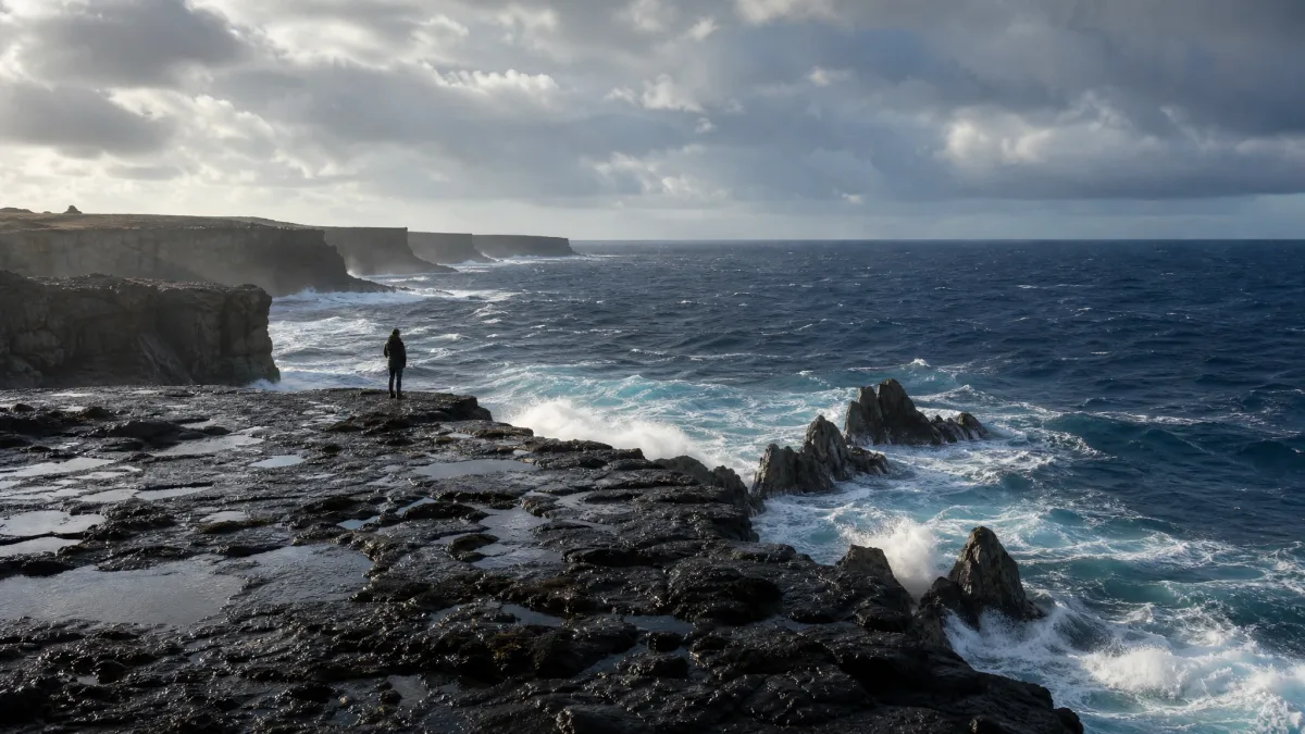
No, and attempting it means facing armed patrol boats. The sheer dark cliffs rising directly out of the western South Atlantic mark Trindade Island, an outpost without passenger ferries or runway tarmac.
The perimeter is shut tight. A small contingent of roughly thirty rotating Brazilian Navy personnel and accredited researchers forms the entire human presence on the rock. Getting ashore demands official government accreditation through naval research boards, ruling out civilian yachts, cruise diversions, and casual tourists.
Skip the dream of landing here unless you carry a federal research grant. The administrative wall is taller than the volcanic bluffs.
💡 Tip: Research applications must go through the Brazilian Navy SECIRM department two years in advance.
Quick Tips Before You Start
Secure State Sponsorship
Never point a bow toward military stations without formal scientific clearances from sovereign defense ministries.
Match Freight Cycles
Supplies on remote inhabited atolls run on rigid cargo ship schedules that leave months of dead time between runs.
Respect Exclusion Zones
Strict maritime sanctuaries carry severe criminal penalties and impoundment risks for unpermitted coastal landings.
2. Palmerston Atoll Community Settlement
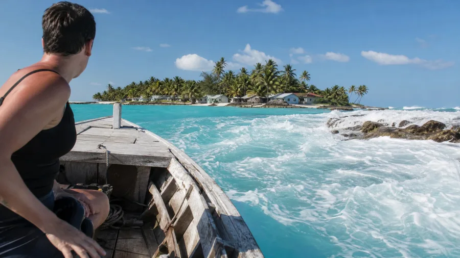
Securing military entry to a garrisoned rock is impossible, but reaching an inhabited coral ring 310 miles from Rarotonga simply demands deep pockets and iron sea legs. Chartering passage across that two to three day stretch of open ocean will run around $3,500 per berth on private yachts, offering the only way into Palmerston Atoll outside the three or four cargo runs that show up each year. The reward is stepping into a community of under sixty-five residents who all trace their lineage to nineteenth-century carpenter William Marsters.
Bring cash and brace for the surf. Voyagers looking for tropical shores with far simpler logistics might prefer budget Caribbean islands that avoid demanding open-ocean charters. The absence of an airstrip or sheltered anchorage forces you into small skiffs that run straight across crashing outer barrier breakers into the lagoon.
Palmerston Atoll — At a Glance
📍 Coordinate
18°04′S 163°10′W
👥 Population
Under 65 residents
🚢 Supply Ship
2–4 visits yearly
🌊 Anchorage
Open roadstead
Access Protocol
Boats must anchor in deep water off the barrier reef and wait for a resident family host skiff.
3. Saint Matthew Island Wilderness Preserve
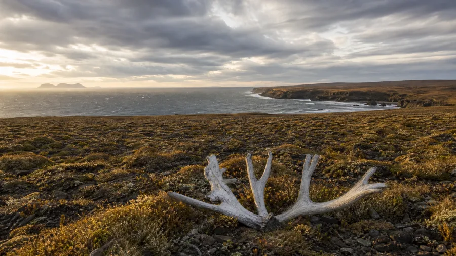
Cold diesel exhaust and wet salt fog hit your face the moment the zodiac engine cuts out 185 miles west of Nunivak Island. Out here in the center of the Bering Sea, Saint Matthew Island greets you with silence and bleach-white bones scattered across the tundra. It marks the bleakest wildlife graveyard in American waters.
A herd of 6,000 introduced reindeer starved down to 42 during the bitter winter of 1966 after eating every scrap of lichen on the plateau. Today, the Alaska Maritime National Wildlife Refuge runs the territory under tight research rules that firmly outlaw casual camping or independent recreation.
Pack ice retreats only for a brief midsummer pause. Getting ashore requires an ice-strengthened hull and specialized permits, meaning ordinary pleasure cruisers can scratch this one off their route entirely.
4. Agalega Islands Copra Outpost
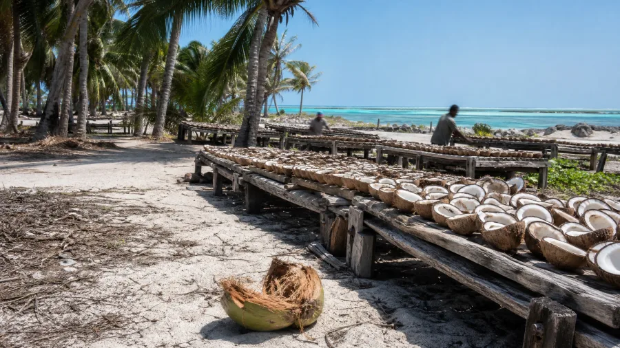
The smell of smoldering coconut husks hits your face before the hull scrapes sand.
Leaving the subarctic chill behind exposes an Indian Ocean sandbar that is trading open-water isolation for military concrete. Two flat coral strips sit 660 miles north of Port Louis in Mauritius, where three hundred villagers earn their living turning coconuts into dried copra and pulling parrotfish off the reef. You will not find guest houses, dive shops, or rental scooters anywhere along the shore. Travelers who still crave peaceful coastal scenery without administrative lockouts can explore quiet beach towns that remain largely overlooked by crowds.
State-built tarmac recently replaced the rough, three-week cargo ship run from the capital. But do not expect commercial tickets. Every inbound flight operates under tight government surveillance, leaving unauthorized travelers stranded at the perimeter.
If you secure government clearance, dinner means sitting down to a plate of fresh cari pwason with boiled breadfruit. It costs about $4 across an informal family kitchen, washed down with sweet coconut water straight from a split green shell.
Without official paperwork, you will never get close enough to taste it.
💡 Tip: Visitors must submit personal vetting to the Outer Islands Development Corporation months prior.
Outer Island Permit Clearance Route
5. Inaccessible Island Seabird Sanctuary
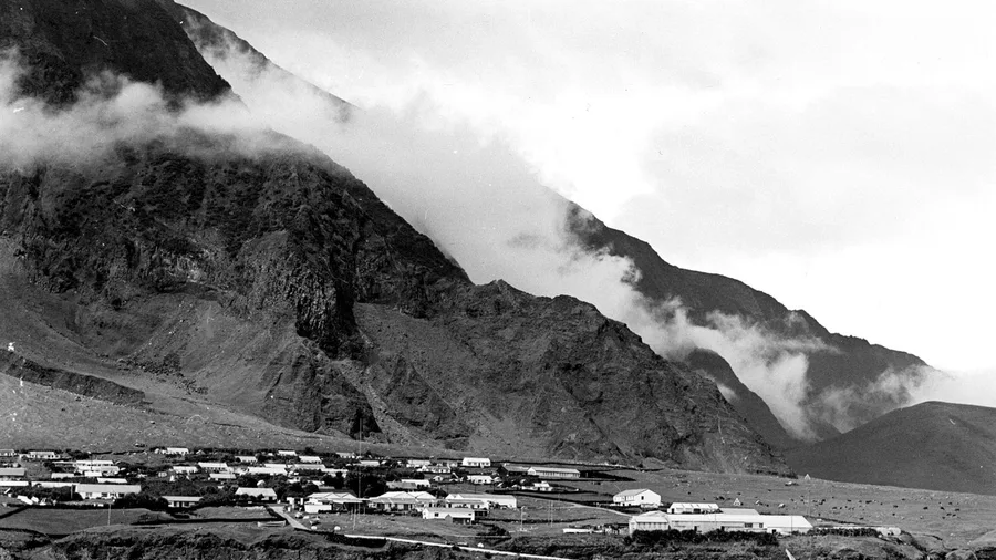
Twenty-eight miles southwest of Edinburgh of the Seven Seas, a wall of dark volcanic rock rises 1,000 feet straight out of the cold South Atlantic.
While other archipelagos shut out casual tourists through sheer administrative neglect, this uninhabited plateau stays sealed behind cliffs, pounding surf, and strict local law. Tristan islanders head out here only during rare weather windows to harvest driftwood or monitor the endemic rail, the smallest flightless bird on Earth. You cannot drop an anchor or set foot on the boulders without written permits from the Island Council and two local guides handling your boat through the surge.
6. Amsterdam Island Subantarctic Station
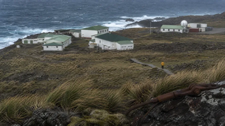
Amsterdam Island is an oceanic research station battered by subantarctic gales.
Far beyond Tristanian waters, entering the higher southern latitudes means trading open fishing skiffs for berths aboard government hulls. The Martin-de-Vivies station sits 2,600 miles southeast of Madagascar, keeping twenty to forty French scientists stationed through endless wind. In 1871, a French farmer named Heurtin attempted to colonize the volcanic plateau with cattle, only for the settlement to collapse, abandoning livestock that tore through the endemic flora for over a century.
Today, strict ecological quarantine protects the world's last breeding colonies of the Amsterdam albatross along the sheer western cliffs. You cannot book a private yacht charter into this zone; entry runs strictly through berth allotments on the supply ship Marion Dufresne II during scheduled research rotations.
⚠️ COMMON MISTAKE
Assuming Private Yachts Can Anchor Anywhere
Sovereign boundary laws in subantarctic and conservation territories carry harsh confiscation penalties. Crossing into an exclusion boundary without a paper clearance can trigger naval interception and heavy fines.
7. Minami-Tori-shima Defense Perimeter
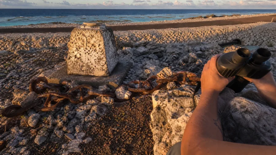
Do not steer your keel within dozens of nautical miles of this triangular reef, because Tokyo enforces an airtight military seal across the water.
Track your chart 1,148 miles southeast of Tokyo into the open ocean, where Japan stakes its easternmost frontier on a triangular speck of coral devoid of neighbors. You cannot buy a passage, charter a tender, or drop an anchor without courting interception by armed patrol ships. The state bars civilian ferries, commercial air charters, and private yacht moorings entirely. Only rotating garrisons from the Maritime Self-Defense Force and meteorologists from the Japan Meteorological Agency walk the gravel airstrip. Tokyo guards the surrounding exclusive economic zone with relentless scrutiny, locking down seabed mud packed with colossal rare-earth mineral deposits that civilian voyagers will simply never be permitted to see.
💡 Tip: The surrounding waters are classified as a sovereign security perimeter under active naval radar.
8. Bear Island Weather Post

Drop hook on the leeward shelf and spend an hour watching northern fulmars wheel across stone.
Anchorages here offer zero dockside amenities, pinning sailors against open swells 146 miles south of Spitsbergen in the gray expanse between Norway and Svalbard. Dense fog banks roll over the chop in minutes, bringing sudden drifting pack ice that threatens to trap unprotected wooden or fiberglass hulls. Your only neighbors are nine Norwegian meteorologists tracking polar storms from the Herwighamna outpost. Idle on deck beside Cape Kolthoff, where southern sea cliffs rear straight out of the surf under the cacophony of hundreds of thousands of Arctic seabirds.
9. Rapa Iti Mountain Bastions

Rapa Iti is a drowned volcanic caldera where jagged ridges slice the cold southern edge of French Polynesia.
Clear past the Tropic of Capricorn, 770 miles south of Tahiti, no tarmac runway connects these serrated green peaks to the outside world. Around 500 residents live inside the protected rim of the collapsed crater, completely off the grid of commercial airlines. If you secure passage, you do it aboard the Tuhaa Pae freight vessel on its monthly cargo run out of Papeete, sleeping among deck crates for days across open ocean swells.
Climbing into the clouds costs nothing once you step ashore. Ridge paths lead up to massive stone fortresses called pa, carved by ancient rival clans who battled over terrace farming and freshwater springs centuries ago. Standing among the drystone terraces with wind howling through the notch gives you unbroken views of empty blue horizon in every direction, totally free of ticket kiosks, tour groups, or modern resort trappings.
10. Suwarrow Atoll National Reserve
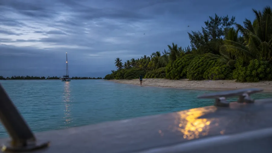
515 miles of open ocean north of Rarotonga brings you to an empty coral ring with zero permanent residents.
Unlike populated Polynesian valleys where villages welcome supply freighters, this national park belongs strictly to nesting seabirds. Author Tom Neale spent years surviving alone on Anchorage Island as a famous recluse, but today you cannot simply drop hook and pretend you are him.
The catch is severe administrative oversight.
Two Cook Islands caretakers arrive only between May and October to monitor yacht crews and run aggressive biosecurity checks for invasive rats. Outside this specific dry-season window, entering the lagoon is strictly illegal, and you must clear official ports like Rarotonga first before even aiming your bow here.
Sailors who arrive unannounced or attempt an off-season anchorage face immediate expulsion and heavy maritime fines.
💡 Tip: Rangers inspect hulls for invasive rats before granting lagoon anchoring clearance.
Expedition Realities: Self-Sufficient Sailing vs. Cargo Berths
Private Expedition Yacht
- Total control over arrival timing and seasonal weather windows
- Demands self-sufficient watermakers, spare sails, and medical stores
- High risk of reef groundings and violent anchorage drag
- Mandatory harbor fees and permit filings at every waypoint
Supply Vessel Bunk
- Fixed transport schedules operated by veteran professional crews
- Guaranteed landing clearance through existing government manifests
- Zero personal responsibility for vessel maintenance or repairs
- Risk of multi-week itinerary delays from open-ocean mechanical issues
11. Bouvet Island Ice Fortress
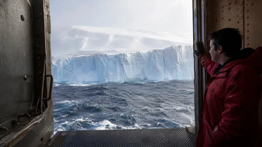
Trade tropical lagoon moorings for frozen subantarctic seas, and your odds of an easy landing collapse to zero. Bouvet Island sits roughly 1,600 miles south-southwest of South Africa's Cape of Good Hope, holding the undisputed crown as the most isolated uninhabited landmass on Earth.
Over 90 percent of the territory remains smothered under glacial ice sheets ending in vertical walls over churning swells. This Norwegian dependency holds automated weather and ocean sensors rather than people, making it completely impossible for family tourists or recreational sailors; access belongs strictly to polar research teams running heavy icebreaker expeditions with flight decks for helicopter drops.
🧭 Planning an Extreme Oceanic Voyage
Research Jurisdiction
Identify which national authority controls island waters and conservation rules.
Apply for Scientific Clearance
Submit research proposals to governing ministries twelve to twenty-four months out.
Complete Ecological Screening
Pass biosecurity certifications to guarantee zero rat or seed contamination.
Charter Verified Transport
Contract an ice-class hull or book a government cargo bunk.
12. North Sentinel Island Tribal Sanctuary

Steer clear of this shoreline unless you want an escort straight into Indian federal custody. Even an accidental approach within 22 miles west of South Andaman Island puts you on the radar of armed maritime patrols guarding the Bay of Bengal.
Between 50 and 200 Sentinelese live here in complete seclusion from modern society, protected behind an inviolable five-nautical-mile maritime exclusion perimeter enforced around the entire coast by the Indian Navy and Coast Guard. Indian law enforces strict criminal prohibitions against landings, boat approaches, and scientific flights to protect the uncontacted tribe from deadly outside pathogens.
The only legal visual you will ever take away is from thousands of feet up through a commercial airliner window on a clear day between Port Blair and the mainland, watching the dense green canopy meet pale breaker reefs from safely above.
Frequently Asked Questions
Can you legally visit any of these islands as a tourist?
Palmerston Atoll and Rapa Iti allow civilian visitors who arrange passage on scheduled cargo freighters or cruise tenders. Outposts like North Sentinel Island, Bouvet Island, and Minami-Tori-shima are completely closed to tourists due to indigenous protection, severe geography, or military restrictions.
What happens if a private boat enters a protected island zone?
Entering sovereign maritime boundaries without written permission results in immediate interception by coast guard or naval units. Violators face steep fines, vessel impoundment, and potential criminal prosecution under national security or ecological protection laws.
How long does it take cargo ships to reach these outposts?
Transit times range widely depending on the ocean basin. Reaching Palmerston takes two to three days from Rarotonga, whereas reaching Amsterdam Island on the Marion Dufresne II requires more than a week of rough open-ocean voyaging from Réunion.
Are there medical evacuation options on these isolated islands?
Virtually none exist within short timeframes. Most of these outposts lie well outside civilian helicopter range, meaning emergency evacuations require days of sea transport on coast guard vessels or polar ships.
Why are biosecurity protocols so strict on isolated islands?
Isolated islands developed unique ecosystems free from continental pests. Introducing a single pregnant rat, invasive weed seed, or foreign bird pathogen can annihilate endemic flightless bird colonies within a few seasons.
Charting Your Boundaries Between Map Study and Ocean Passage
Leave Bouvet Island and North Sentinel Island purely to your map table: sheer glacial ice and strict federal exclusion permanently bar recreational human landfall. If you command a self-sufficient, bluewater vessel, Palmerston Atoll, Suwarrow Atoll, and Rapa Iti present genuine horizons across hundreds of nautical miles of open swell, provided your crew can negotiate breaking barrier reefs and local governance.
Before setting a single course away from mainland harbors, secure written ministerial, naval, or island council permits months in advance. That single piece of paper dictates whether an empty patch of ocean welcomes your anchor or turns your hull back at gunpoint.
Check the Access Table Before Plotting Your Next Route
Review our logistics summary at the top of this guide to compare sovereign jurisdictions and required transit methods.