
Half Dome's cable day is 16 miles, 4,800 feet of gain and 10 to 12 hours, which reframes what a famous hike actually asks of you.
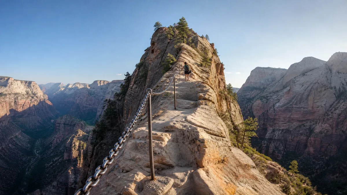
The image is the chain on Zion's Angels Landing, a 4.8-mile round trip with 1,500 feet of gain, or the cables on Yosemite's Half Dome. Walk in equating iconic with worth the effort and the photo has already sold you a day you haven't costed out.
What the photo hides is time and hazard: 3 to 5 hours on Zion's chain against 10 to 12 on Half Dome, plus season, exposure, altitude, heat or mud doing the deciding.
The useful question is effort to payoff. Which trail's miles, gain, hours and one hazard fit your legs and the single vacation day you actually have?
By the end you can name the next hike, quote its distance, gain and typical time, and know whether to book a spring Zion day, a summer Yosemite day or a fall desert half-day. The right hike isn't the most famous one. It's the one whose numbers match your fitness and your day.
Quick Tips Before You Start
Check the season
Most of these hikes have a narrow window: July–September for Glacier and Rainier, spring–fall for Zion.
Carry more water than you think
Even the short ones like Delicate Arch (3 miles) are exposed; bring at least 2 liters per person.
Start early
Trailhead parking fills by 7 a.m. at Zion, Yosemite and Arches; an early start also beats the heat.
Know the crux
Every hike here has one decisive hazard—chains, cables, altitude, heat, mud or rungs. Read that part twice.
Download the map offline
Cell service is patchy or nonexistent on most of these routes; have the route saved before you drive in.
Check permits
Half Dome cables require a permit; Mount Whitney has a lottery. Confirm access rules on the official park page.
1. Angels Landing: Zion's Exposed Chain Finish
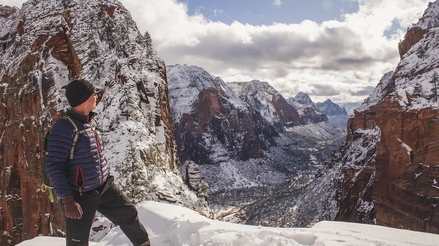
The chain section at the top of Angels Landing is where people freeze, and no photo prepares you for it: a fixed cable, a 1,500-foot drop on both sides, and a line of hikers waiting behind you. The route is 4.8 miles round trip with 1,500 feet of gain, 3-5 hours in spring through fall. That mileage fits a travel day, but the final ridge is the crux, and the exposure keeps going past the last chain handhold.
The payoff is the most theatrical view in Zion, the canyon opening below you in layers of red and green. The effort is concentrated in the last climb, not the total distance. Start early to beat the heat and the chain-section traffic, and to have a real chance of seeing bighorn sheep on the sandstone benches before the crowds push them off the trail. It suits confident hikers; exposure, not fitness, is the decisive test.
💡 Tip: Start at the Grotto trailhead by 7 a.m. The first shuttle from the visitor center fills up, and the chain section gets congested by mid-morning.
| Hike | Location | Distance | Elevation gain | Typical time | Best season |
|---|---|---|---|---|---|
| Angels Landing | Zion National Park, Utah | 4.8 mi RT | 1,500 ft | 3–5 hr | Spring–fall |
| Half Dome | Yosemite National Park, California | 16 mi RT | 4,800 ft | 10–12 hr | Summer |
| Grinnell Glacier | Glacier National Park, Montana | 10.6 mi RT | 1,600 ft | 5–7 hr | Jul–Sep |
| Mount Whitney | Sequoia National Park, California | 22 mi RT | 6,100 ft | 12–16 hr | Jul–Oct |
| Bright Angel Trail | Grand Canyon National Park, Arizona | 9 mi RT | 3,000 ft descent | 5–7 hr | Spring–fall |
| Kalalau Trail to Hanakapiai | Kauai, Hawaii | 4 mi RT | 1,200 ft | 3–4 hr | Year-round |
| Delicate Arch | Arches National Park, Utah | 3 mi RT | 480 ft | 1.5–2.5 hr | Year-round |
| Highline Trail | Glacier National Park, Montana | 11.8 mi one-way | 800 ft | 5–6 hr | Jul–Sep |
| Precipice Trail | Acadia National Park, Maine | 1.6 mi loop | 1,000 ft | 1–2 hr | Summer–fall |
| Skyline Trail | Mount Rainier National Park, Washington | 5.5 mi loop | 1,700 ft | 3–4 hr | Jul–Sep |
| Lost Mine Trail | Big Bend National Park, Texas | 4.8 mi RT | 1,100 ft | 3–4 hr | Fall–spring |
| Clouds Rest | Yosemite National Park, California | 14.5 mi RT | 2,700 ft | 7–9 hr | Summer–fall |
2. Half Dome: Yosemite's Cable Route Test
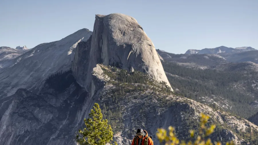
Half Dome is a 16-mile round trip with 4,800 feet of gain and 10-12 hours on the trail in summer, a full-day commitment that starts before dawn. A short trail decided by exposure is one thing; this one raises the same fixed-aid question across sixteen miles and a very early alarm.
The cable section comes at the nerve point, after hours of climbing: steep granite, fixed cables, and real exposure. The strenuous effort compounds with altitude and weather, so legs and discipline matter far more than the iconic photo. Yosemite locals often skip the cables and the permit lottery entirely, heading instead for Clouds Rest, which is higher, quieter, and 14.5 miles round trip with 2,700 feet of gain and 7-9 hours. It trades cable nerves for distance and a narrow summit ridge, and it is the fitter hiker's quiet alternative.
Half Dome still suits a fit hiker ready for the early start and the long day. The summit view is earned by the full circuit, and weather can turn the cables into a genuine danger, so check conditions before you commit.
💡 Tip: Apply for the cable permit in the preseason lottery (March). If you don't get it, Clouds Rest (#12) is a strong alternative with no cables.
3. Grinnell Glacier: Glacier's Ice and Lakes
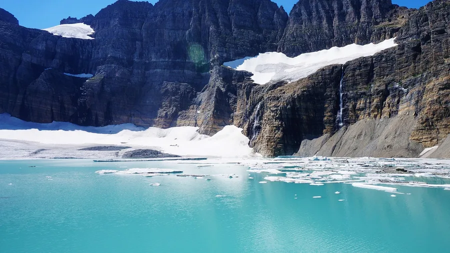
Grinnell Glacier asks less nerve than a cable route and more patience: 10.6 miles round trip, 1,600 feet of gain, 5-7 hours. That gain works out to roughly 150 feet per mile, gentle enough that your legs, not your hands, carry the day. You are trading the fixed-line drama for a long, even walk into the ice.
The season is short, July through September, and the route climbs toward a glacier that is visibly shrinking, past turquoise lakes set against big mountain walls. This is bear country, so carry spray and know how to use it, and make noise on the wooded stretches. The payoff starts early: lakes and walls open up within the first hour, and the glacier is the finish rather than the only reward.
Waterton or Many Glacier makes the natural base, and the hike eats most of a day. Budget 5-7 hours on the trail, pack lunch for the halfway benches, and remember the payoff is measured in constant views rather than one summit moment. Steady hikers who accept the bear-country rules and a moderate climb over a long distance get the biggest return of any full-day route in the park.
💡 Tip: Park at the Swiftcurrent trailhead early—the lot fills by 8 a.m. in July. Bring layers; the weather at the glacier can be 20 degrees colder than the trailhead.
Two Half Dome Myths
4. Mount Whitney: Highest Lower 48 Summit
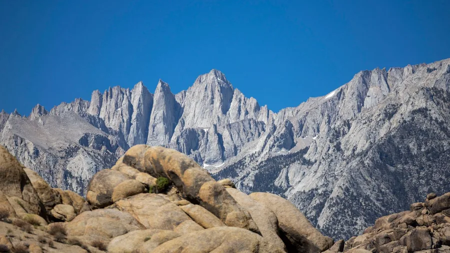
Above 13,000 feet on Whitney, the air goes thin and cold enough that your own breathing turns into a sound you hear over your footsteps, and the sky at dawn looks washed pale rather than deep blue. This is the lower 48's highest summit, and the trail to it is a full-day endurance route: 22 miles out and back, 6,100 feet of gain, and 12 to 16 hours between start and finish, which means a headlamp on both ends.
Grinnell hands you a long day with modest gain. Whitney keeps that same length and then stacks a wall of vertical and a summit near 14,500 feet on top of it, so training and weather become the two things that decide the outcome. July through October is the workable window. Trailhead access requires a permit from the Forest Service permit system, and in the quota season you book well ahead; without one, the day does not happen.
The wildcard is altitude, and it does not care how fit you are. A runner who has never slept above 8,000 feet can go flat and nauseated around 12,000 and get turned around while a slower hiker keeps plodding upward, so plan to acclimate at the trailhead the night before and treat a headache and nausea as a signal to descend rather than push.
The cult status makes this a genuinely crowded mountain for a remote summit. Permit quotas cap the numbers but do not eliminate them, so expect company, especially on summer weekends, and expect the switchbacks above Trail Camp to feel like a conga line.
The payoff is the summit, but the day rewards preparation over nerve. Start well before dawn, carry layers and enough water, and check the forecast the morning you go; a storm on the exposed upper ridge is not a place to test your luck. For a well-trained hiker who respects altitude instead of just mileage, the effort-to-payoff match is real. For anyone counting only miles, it is a trap.
💡 Tip: The Mount Whitney lottery runs in February for the summer season. If you don't get a permit, consider the Mount Whitney Portal to Lone Pine Lake hike (6 miles round trip) for a taste of the trail.
5. Bright Angel Trail: Grand Canyon Below Rim
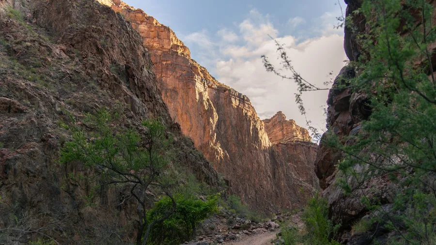
Nine miles round trip and 3,000 feet of descent, 5 to 7 hours in spring or fall. That is the shape of the walk to Havasupai Gardens, and the number that matters is not the distance down. The whole profile inverts here: the descent comes first and feels effortless, then the canyon hands back every foot as a climb, all of it at the end when your legs have already spent their best energy.
The entry fee for this is just the park admission, around $35 per vehicle for a week, but the real splurge is time and water. Heat is the decisive hazard and the climb out is the test, so start at first light, carry more water than feels reasonable, turn around at Havasupai Gardens rather than pushing farther, and save the effort for the ascent. Suits hikers who stop early; the payoff is below-rim scale and canyon walls closing overhead, and the match holds only if the turnaround is honest.
💡 Tip: Start before 6 a.m. in spring and fall; the trail is exposed and hot by mid-morning. Carry at least 3 liters of water per person.
⚠️ COMMON MISTAKE
Don't turn around late
On canyon and altitude hikes, the turnaround time matters more than the destination. Set a hard time (e.g., noon) to start back, and stick to it—the climb out takes longer than the descent.
6. Kalalau Trail: Kauai's Hanakapiai Section
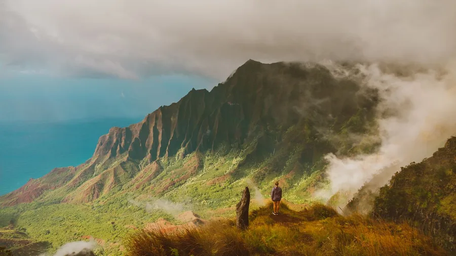
Stop at Hanakapiai Beach. The Kalalau Trail's first stretch is the smart day hike on Kauai's north shore, and the blockbuster is not the only thing worth your vacation day. You get 4 miles out and back, roughly 1,200 feet of climbing, and 3 to 4 hours, which leaves the afternoon free and still puts you on the ocean shelf that sells the trail's name.
What you are buying is footing, not altitude, and the cost shows up as soon as it rains. The path turns slick clay, stream crossings swell to knee height, and the drop to the surf is right there; where an alpine trail offers a handline, this one offers mud, and you slow to a shuffle on the steep, slick pitches. The payoff is jungle hanging over the water, sea cliffs dropping away under the track, and a boulder-strewn beach at the turnaround where you can sit for an hour and do nothing.
It suits sure-footed hikers who will stop at Hanakapiai; the full route to Kalalau is a separate trip with permits and camping, not the day-hike objective. The effort-to-payoff match depends on accepting wet, slippery ground and turning around where the beach ends, unlike US mountain towns before winter.
🥾 How to Plan a Bucket-List Hike
Pick your season
Match the hike to its window—Glacier in July–September, Zion in spring–fall.
Check permits
Half Dome, Mount Whitney and Angels Landing all have lotteries or permits.
Train for the gain
Build up to the elevation gain with local hill repeats and long walks.
Plan your start
Most trailheads fill by 7 a.m.; arrange parking or shuttle the night before.
Pack the essentials
Water, layers, sun protection, map and a headlamp—even for day hikes.
7. Delicate Arch: Arches at Sunset
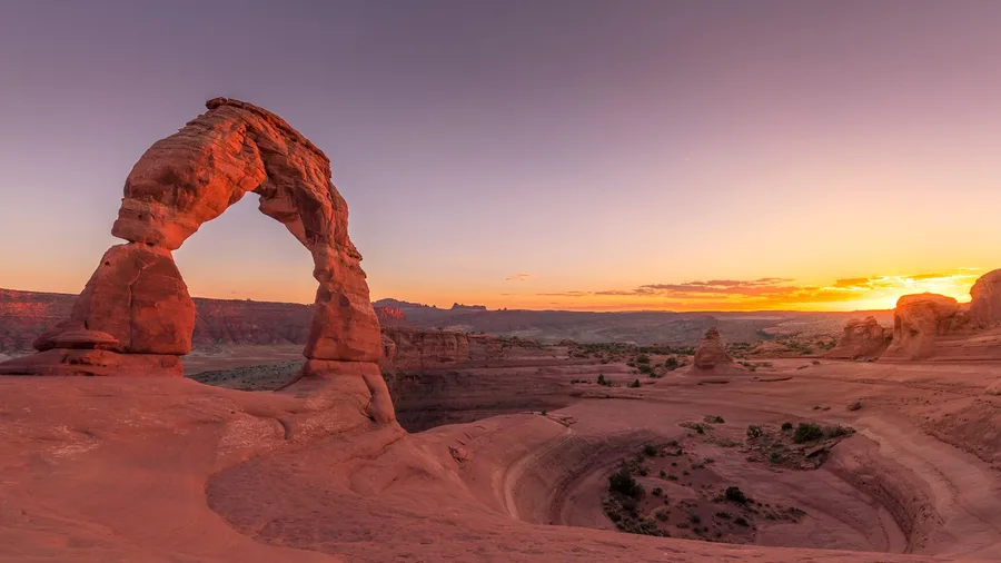
Sunset, and it's not close. The 3-mile round trip and 480 feet of gain take 1.5 to 2.5 hours and the trail runs year-round, so the climb is a compact one — the timing is what you're deciding, not your legs.
There's no tree for the last stretch, just open slickrock baking in the afternoon sun, so carry more water than a 3-mile walk suggests and start about two hours before the sun drops. That puts you in the slickrock bowl as the light goes orange, the arch cutting a shadow across it while the crowd behind you shifts for space. Families, casual hikers and first-timers can all make the top; the access is what makes this the easiest big payoff on the list, as long as you respect the heat and the sunset clock.
💡 Tip: Arrive at the trailhead 2 hours before sunset to get a parking spot and claim a viewpoint. Bring a headlamp for the walk back.
8. Highline Trail: Glacier's Ledge Walk
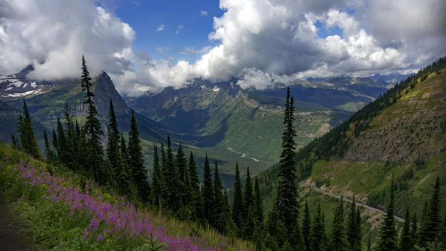
The first thing that registers is the handline: a steel cable bolted to the rock wall, cold and slightly greasy, and you grip it before you've decided to. On the Highline the trail pinches to a ledge beneath the Garden Wall, and the drop to the parking lot is straight down to your left.
The exposure is manageable, but only if you're at ease walking a long contour close to a fall line for the better part of an hour. If you tense up there, the remaining 11 miles will be a grind.
The full day is 11.8 miles one-way with just 800 feet of gain, 5 to 6 hours between July and September. The low vertical is the catch people don't price in: this is a distance-and-logistics hike, not a climb. You finish at a different trailhead, so the shuttle becomes the day — plan the exit with the same care as the start, because the last bus leaves without you.
What you get for the long traverse is valley views the entire way, ridgelines stacked behind each other and the road a thin thread far below. You don't summit anything. The payoff is the contour itself.
Take it if a steady ledge and a well-planned shuttle sound like a good day. Skip it if a narrow walk with a drop is the thing that would ruin your trip, or if you want a summit at the end. The Highline doesn't give you one.
💡 Tip: Check the shuttle schedule and road status before you go; the Going-to-the-Sun Road can close for weather.
Half Dome vs. Clouds Rest: Which Yosemite Summit?
Half Dome
- 16 miles round trip, 4,800 ft gain
- Cables require a permit
- 10–12 hours, exposed cable section
- Iconic, but crowded
Clouds Rest
- 14.5 miles round trip, 2,700 ft gain
- No permit required
- 7–9 hours, narrow ridge finish
- Quieter, higher, no cables
9. Precipice Trail: Acadia's Iron-Rung Climb
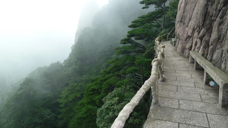
Know before you commit: Precipice is a scramble with iron rungs and ladders bolted into the cliff face, not a trail with a viewpoint. The 1.6-mile loop packs 1,000 feet of gain into 1 to 2 hours, and the climbing is the point.
Do it in summer or fall and go early to beat both the heat and the queue at the rungs, because on a busy morning you'll wait on the exposed rock for the person above you to move. From the top, the Atlantic opens below the pink granite of the coast and Mount Desert Island spreads out behind you. It's the airy shot of Acadia, earned by nerve rather than distance. Confident scramblers who don't mind heights get the biggest return per mile on any list here; small kids and anyone who freezes on fixed hardware should take a gentler loop instead.
💡 Tip: Check the park's peregrine falcon closure dates before you go; the trail typically opens in late summer.
10. Skyline Trail: Rainier's Wildflower Loop
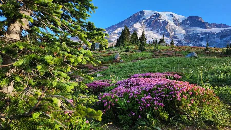
Five and a half miles, 1,700 feet of gain, three to four hours, and no summit to bag at the end. Skyline is the Rainier hike for the person who wants the mountain's upper world without the iron-rung nerve test, and it earns its place on a list that otherwise rewards exposure and endless mileage.
You climb through Paradise and the meadows open up in front of you, paintbrush and lupine to the knee, the glacier hanging above it all. The trail keeps contouring through alpine country, so the scenery arrives the whole way around rather than in one payout at the top. It is a loop, which means no shuttle puzzle and no retracing your steps.
The catch is the calendar. July through September is the window, and outside it the snow decides for you. Inside it, the effort is moderate for what you see, and that is the trade: not nerve or altitude or desert sun, but a short season and a half-day's walk for a full alpine return. Go for the wildflowers and the glacier, and go while the snow is gone.
Your First 3 Hours on Skyline Trail
11. Lost Mine Trail: Big Bend's Desert Ridge
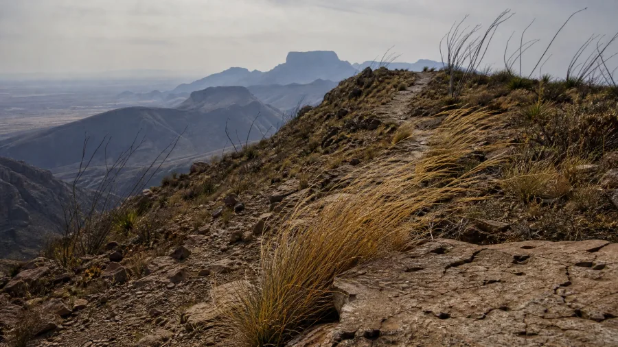
On Lost Mine, yes. You climb 1,100 feet in three to four hours to a ridge where the Chisos drop away and the desert floor runs out flat and pale to the horizon. It is the short hike that makes the park legible.
The desert sets the terms here, as it does across the range: fall through spring is the season, and sun exposure decides the day, so start early and carry more water than four miles suggests. Get it right and you have a scenic half-day for the price of an afternoon, which is the effort-to-payoff match this ridge was made for.
Lost Mine Trail — At a Glance
📏 Distance
4.8 mi RT
⛰️ Elevation gain
1,100 ft
⏱️ Typical time
3–4 hr
☀️ Best season
Fall–spring
🚗 Trailhead
Lost Mine Trailhead, Basin Junction
Why it works
A short climb to a ridge with panoramic views—no permit, no crowds.
12. Clouds Rest: Yosemite's Narrow Summit
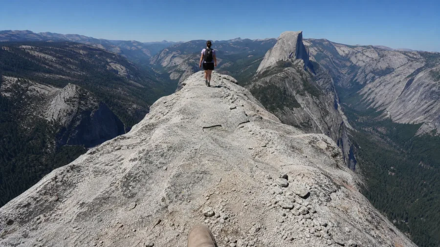
The last few hundred feet are the part you will remember: the ridge narrows to a spine of rock with air on both sides, and you walk it because there is nothing else to hold.
Clouds Rest is 14.5 miles round trip with 2,700 feet of gain, seven to nine hours in summer and fall. That is a fit hiker's full day, not a casual one. The knife-edge summit ridge is the crux, and it asks for footing and a cool head more than it asks for hands.
What you get for it is the valley spread out below without the cable route's crowd or the cable route's fear. Clouds Rest sits higher than Half Dome and takes less gain, though the day runs long either way. Where the cable route trades on exposed granite and a permit lottery, this trades on distance and a narrow finish.
So it suits the fit hiker who wants Half Dome's view and none of its cables, and who can keep steady legs for fourteen-plus miles. It does not suit a family day, a first big hike, or anyone uneasy on a narrow ridge with real drops. The summit is no place to talk yourself into something.
That is the honest measure: you give up the cables and the icon, and you take on a longer walk and a thin strip of rock at the top. For the right hiker, quieter, higher and cheaper on nerve, that is a better day than the one the photo promised.
💡 Tip: Start from the Sunrise Lakes trailhead or Tenaya Lake; the latter adds a bit of distance but is easier to access.
Frequently Asked Questions
Which of these hikes is best for a first bucket-list trip?
Delicate Arch or Skyline Trail. Both are under 6 miles with moderate gain, have huge payoffs, and don't require permits or technical skills. Delicate Arch is year-round; Skyline is best July–September.
Do I need permits for any of these hikes?
Yes: Half Dome cables require a Yosemite permit (preseason lottery), Mount Whitney requires a permit (February lottery), and Angels Landing uses a lottery. Check the official park pages for current rules.
How fit do I need to be for Mount Whitney or Half Dome?
Both are full-day endurance hikes with significant gain (6,100 ft and 4,800 ft). You should be comfortable hiking 10–12 hours with a light pack and have trained on similar elevation gains. Altitude can affect anyone, so acclimatization helps.
What's the best time of year for these hikes?
Most are summer or fall hikes: Glacier and Rainier in July–September, Zion in spring–fall, Mount Whitney in July–October. Desert hikes like Lost Mine are best fall–spring. Always check current conditions.
Is the Kalalau Trail to Hanakapiai safe for a day hike?
It's safe for sure-footed hikers who accept mud and stream crossings. The trail is exposed in places, and you should not continue past Hanakapiai without a permit. Check weather and trail conditions before you go.
Match the Hike to Your Legs, Calendar and Nerve
For a first trip like this, Delicate Arch: 3 miles round trip, 480 feet of gain, 1.5 to 2.5 hours, year-round, an iconic sunset for low commitment. If you're fit with one big day to spend, Half Dome: 16 miles, 4,800 feet, 10 to 12 hours, summer, the full cable test. For a half-day, Skyline Trail: a 5.5-mile loop, 1,700 feet, 3 to 4 hours, July to September, alpine scenery without a summit push.
The chain or cable photo is a promise, not an itinerary. Effort-to-payoff fit decides whether Angels Landing, Half Dome or a shorter half-day belongs in your next trip.
Confirm current conditions and any access rules on the official park or forest page before booking. Then buy the trip that matches the day, not the image, and go train for that one instead of collecting them all.
Ready to pick your bucket-list hike?
Use the table above to compare distance, gain and season, then check the park's official page for permits and conditions before you commit.