
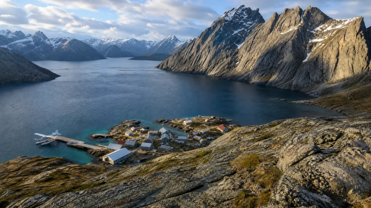
Nearly half a million people live in one South American city that does not connect to a single mile of outside highway.
Most travelers assume every inhabited hub eventually ties into a continental road grid, but sheer terrain stops asphalt cold. Glacial fjord walls, Arctic permafrost, trackless swamps, and open ocean permanently bar vehicle access across the globe.
Reaching these outposts means boarding twin-engine bush aircraft, reserving scheduled river passenger barge journeys that grind along for 3 to 7 days, or hiking sheer mountain trails. Round-trip air charter or scheduled ferry fares run between $150 and $650 per passenger, with luggage strictly capped at 40 to 50 pounds.
Here is how to reach the world's most defiant roadless outposts by air, water, and trail, and how each settlement navigates daily life on its own canals, footpaths, and ice tracks.
Quick Tips Before You Start
Weigh Gear Early
Bush planes strictly cap personal baggage at 40 to 50 pounds total.
Pad Your Schedule
Allow two buffer days because sea fog or high winds frequently ground transfers.
Carry Paper Cash
Satellite terminals fail routinely in remote settlements, so carry local paper currency.
Buy Evacuation Cover
Ensure your travel policy specifically covers backcountry air ambulance evacuation.
1. Iquitos, the Peruvian Amazon Metropolis
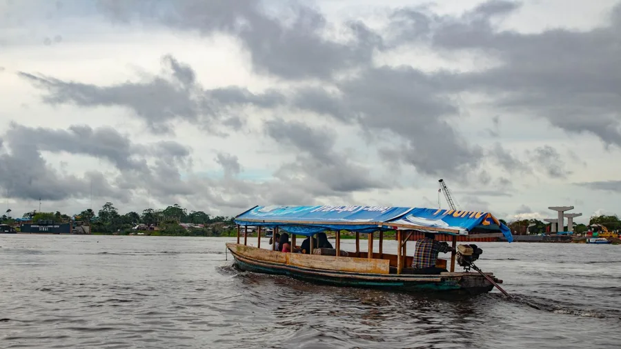
You step out onto the Malecón Tarapacá at dusk and hear the deafening whine of fifty thousand two-stroke engines before you see the water. Down below, the Amazon churns past four hundred and seventy thousand people cut off from the planet's highway network. Reaching this jungle grid means booking a one-hundred-minute jet run from Lima or settling into a scheduled cargo barge for three to seven days out of Pucallpa. South of the docks, a lonely sixty-seven-mile paved ribbon pushes toward Nauta, then dead-ends directly into thick rainforest canopy.
The definitive shot waits at the riverfront railing just as the sun drops behind the floating houses of Belén. Step off the airstrip or the gangway, climb straight into a three-wheeled mototaxi, and pay the driver five soles to point its plastic roof toward the waterfront. The whole city moves on these buzzy three-wheelers and footpaths, proving that half a million urbanites can trade asphalt connections for river channels and never miss a beat.
💡 Tip: Book an enclosed mototaxi during rainy afternoons, as sudden downpours swamp open passenger cabs within seconds.
| Destination | Inbound Transport Method | Internal Transport | Prime Travel Window |
|---|---|---|---|
| Iquitos, Peru | Flight or 3–7 day river barge | Mototaxis and walking | May to September |
| Juneau, Alaska | Jet aircraft or coastal vehicle ferry | Local road spur and city buses | May to August |
| Supai, Arizona | 8-mile foot trail or helicopter | Footpaths and pack mules | March to May |
| Civita di Bagnoregio, Italy | Elevated pedestrian footbridge | Walking and small cargo hand-carts | April to October |
| Inverie, Scotland | Scheduled passenger ferry or 16-mile hike | Dirt tracks and mountain bikes | May to September |
| Giethoorn, Netherlands | Perimeter bus then canal punt | Canals, whisper boats, and bike paths | April to October |
| Zermatt, Switzerland | Cogwheel railway shuttle | Electric taxis and walking paths | December to April; July to September |
| Utqiaġvik, Alaska | Commercial jet flight | Town road grid, quad bikes, snowmobiles | February to March; June to August |
| Churchill, Manitoba | 48-hour passenger train or turboprop | Tundra buggies and walking corridors | October to November |
| Stehekin, Washington | Passenger ferry or chartered floatplane | Valley shuttle bus and gravel paths | June to September |
| Ittoqqortoormiit, Greenland | Turboprop to island airstrip plus helicopter | Dog sled teams and snowmobiles | March to April; July to August |
| Halibut Cove, Alaska | Scheduled water taxi or passenger ferry | Elevated boardwalks and skiffs | June to August |
2. Juneau, Alaska's Landlocked State Capital
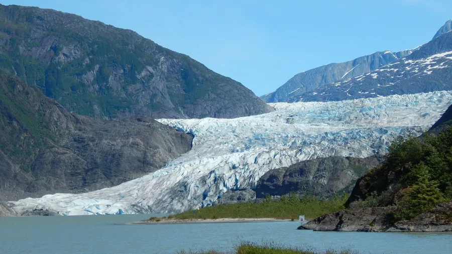
The smell of damp Sitka spruce and diesel exhaust cuts through the chill air long before your ferry ties up at the dock. Thick maritime fjords can trap a wealthy state capital just as permanently as miles of lowland rainforest. Precipitous coastal headlands pin Juneau directly against the massive icefield behind it, sealing off every overland route into northern North America.
Be on deck at five in the morning as the marine ferry glides past the sheer granite walls of Lynn Canal. That narrow fjord is notorious for catastrophic avalanche chutes that repeatedly crushed multimillion-dollar highway proposals before engineers could even break ground. The borough maintains roughly forty miles of paved road, but both directions end abruptly at sheer rock cliffs or salt water.
Incoming travelers enter solely through the commercial runway or via the state ferry system, where booking a vehicle space costs between $150 and $650 per passenger. Leave your car behind at the southern terminus. Local buses and footpaths handle the downtown streets, and walking costs nothing.
💡 PRO TIP
Manage Strict Bush Flight Weight Allowances
Small aircraft operating out of remote airstrips strictly limit baggage between 40 and 50 pounds per passenger. Weigh your bags before leaving your primary hub, because excess weight is routinely left on the tarmac.
3. Supai, the Grand Canyon Havasupai Village
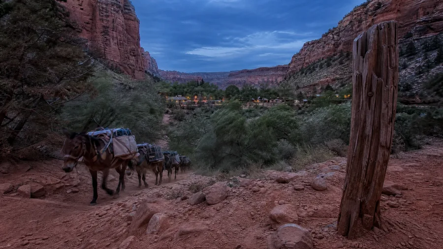
Eight miles of dry switchbacks stand between the rim parking lot at Hualapai Hilltop and the village below. Instead of coastal saltwater or dense jungle, vertical red sandstone walls drop into a completely subterranean desert enclave. You descend on foot into Havasu Canyon, where the tribal settlement operates entirely without cars, relying on the outside world only for what fits through the narrow canyon mouth.
Standing by the dusty trail costs nothing, and watching the daily mail delivery gives you the sharpest picture of canyon logistics. Official United States Postal Service contractors steer working mule strings down the switchbacks, hauling letters, cartons of milk, and dry goods to the village plaza. The tribal council mandates advance permits before anyone reserves trail passage or boards the local passenger helicopter, and baggage holds enforce a strict forty-to-fifty-pound luggage limit.
4. Civita di Bagnoregio in Central Italy
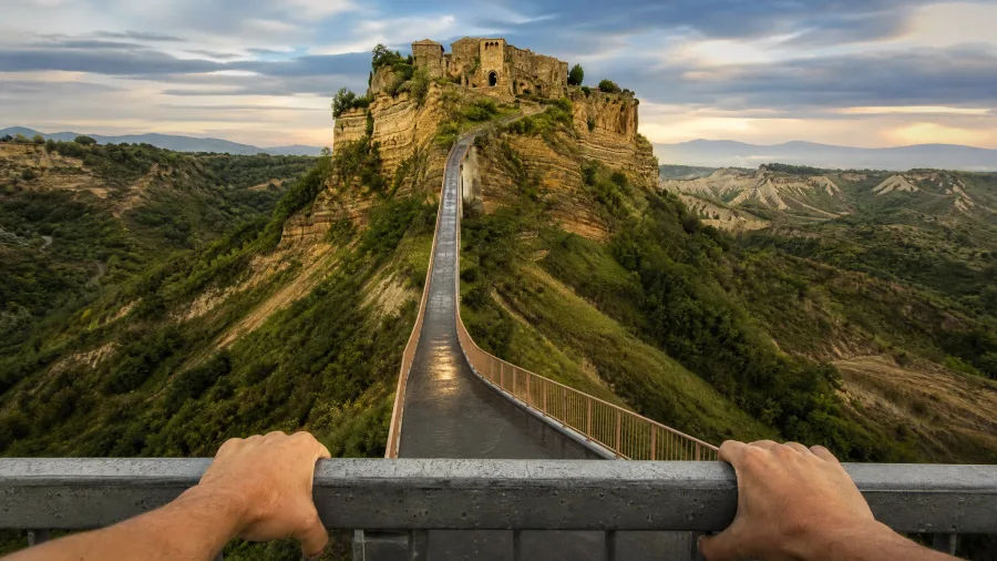
Arrive at the foot of the hill before 8 AM or after 5 PM, because midday turns this dramatic cliff into an absolute bottleneck. While desert canyons trap settlements below the rim, centuries of landslides here carved the opposite barrier, leaving a medieval hilltop isolated on a crumbling spire of volcanic tuff and soft clay.
The approach is a single 1,200-foot reinforced concrete walkway spanning midair from the modern town.
Drop the car in the paid valley bays at the base, pay the mandatory five-euro entry toll that finances constant geotechnical drilling beneath the rock face, and haul your bags uphill on foot. No private automobiles ever pass the gate.
Wheeled cargo is restricted to tiny two-stroke mopeds and manual hand-trolleys clattering over stone cobbles with crates of fresh tomatoes, pasta sacks, and wet cement.
Skip the crowded trattoria right inside the gateway arch. Walk down the alley to the quiet stone courtyard at the eastern edge where the few dozen permanent residents buy bread from delivery crates.
💡 Tip: Pack a small duffel with wheels; the 1,200-foot uphill footbridge climb is brutal with heavy frame backpacks.
Civita di Bagnoregio — At a Glance
🌉 Access Corridor
1,200-ft Footbridge
💶 Pedestrian Toll
€5 Maintenance Fee
🛵 Internal Transit
Mopeds & Hand-Carts
⛰️ Terrain Threat
Clay & Tuff Erosion
Bridge Restriction
All visiting vehicles must park in the lower valley lots; non-resident motor transport is completely prohibited.
5. Inverie and the Remote Knoydart Peninsula

Yes, because steep Munro peaks and tidal sea lochs cut off Inverie on the Knoydart peninsula far more effectively than an ocean channel.
To reach the settlement, you either board a scheduled 7-mile passenger ferry from Mallaig or shoulder full pack gear for a rough 16-mile mountain trek through waterlogged peat bogs. The water crossing requires timing around Atlantic swell and fierce squalls near the loch mouth, with a strong chance of spotting harbour porpoises and minke whales cutting the surface along the ferry track.
No non-resident motor vehicles are permitted past the slipway, leaving bikes and boots as your only transport options. Stop by The Old Forge, mainland Britain's most isolated pub, which draws electricity from a community micro-hydro water turbine while red deer graze the open bracken just behind the taproom.
6. Giethoorn, the Canal-Linked Dutch Hamlet
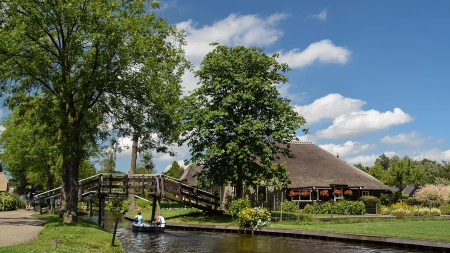
Centuries of peat harvesting hollowed out this Dutch landscape into shallow water channels crossed by more than 170 arched timber footbridges. The trade-off is immediate: midsummer transforms the picturesque waterways into bumper-boat gridlock unless you steer clear between 10 AM and 4 PM.
No cars enter the settlement. Drivers leave vehicles at perimeter asphalt parking spaces and transition immediately to rented electric whisper boats, wooden punts, or bicycles.
Everything that keeps daily life running moves across the canal surface under quiet battery power and long poles. The postal service deploys custom waterborne mail skiffs right to private front decks, while flat-bottomed floating barges collect residential wheelie bins directly from the water's edge.
💡 Tip: Rent your electric whisper boat before 9:30 AM to explore the residential canals before rental queues form.
7. Zermatt, the Car-Free Matterhorn Gateway
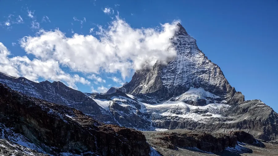
Do not try driving past the terminal barrier at Tasch: local police hand out a mandatory 330-franc fine on the restricted service track, no questions asked. While lowland villages swap pavement for quiet canals, this alpine valley outlawed combustion engines entirely to protect crisp mountain air and keep views of the Matterhorn free of exhaust haze. Pull into the Matterhorn Terminal Tasch, leave your rental car in the multi-story garage, and buy a ticket for the Matterhorn Gotthard Bahn cogwheel train, which departs every 20 minutes for the final twelve-minute ride up the gorge.
You will haul your own luggage off the train platform into an open square buzzing with squat electric runabouts and horse-drawn hotel carriages.
From there, getting your gear across town means pulling a wooden hand-cart provided by your chalet or flagging one of the boxy, licensed battery taxis that rumble over the stone paving. The entire village operates along pedestrian walking paths and two municipal electric bus loops, so plan to walk almost everywhere once your bags are dropped.
8. Utqiaġvik on the Arctic Alaskan Coast
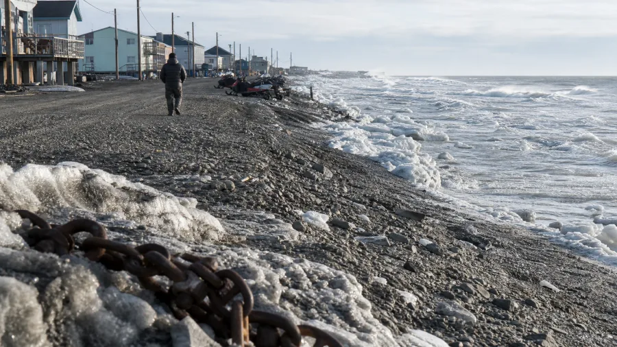
Leaving behind manicured alpine train platforms for the edge of the Arctic Ocean swaps intentional urban design for raw survival geography. America's northernmost incorporated community sits roughly 500 miles north of Fairbanks with zero highway corridors connecting it to the Alaskan interior. Everything on grocery shelves arrives on commercial air freight or during short summer sea barge windows when the Arctic Ocean thaws enough for tugs to push supplies through the ice.
Freight costs dictate restaurant menus directly. Pull up a stool at Brower's Cafe along the gravel shore and order a reindeer sausage burger with seasoned fries, which will run you around $26. That price reflects the real toll of hauling cooking oil, burger buns, and paper goods thousands of miles without a single freight truck line.
Sea freight lands on the beach only once or twice every summer, delivering building materials, packaged pantry staples, and vehicles. You will see Ford pickup trucks and four-wheelers rolling along a few miles of local gravel avenues, but those roads end abruptly at the municipal boundary where the tundra takes over. Those trucks stay confined to town forever because there is simply nowhere else to drive.
Winter shifts the map entirely. Once the ground solidifies, hunters and traveling families run snowmobiles out over hard-packed tundra routes and offshore sea ice paths to reach isolated cabins.
Plan around the shoulder seasons, because spring breakup and autumn freeze-up lock down the whole region for weeks at a time. The sea turns into churning slush too thick for outboard skiffs yet too fragile for heavy snowmobiles, cutting off travel outside the settlement limits until hard frost sets in.
📦 How Remote Settlements Receive Freight
Central Hub Consolidation
Cargo is sorted and palletized at regional supply terminals linked to major rail or deepwater shipping ports.
Strict Weight Auditing
Aviation operators and ferry masters weigh all incoming crates to maintain tight aircraft and watercraft safety margins.
Scheduled Sea or Air Transit
Supplies travel via seasonal barge corridors, commercial cargo turboprops, or coastal vehicle ferries.
Local Intermodal Transfer
Residents collect pallets at docks or airstrips using specialized electric buggies, cargo hand-carts, pack mules, or snowmobiles.
9. Churchill, Manitoba's Subarctic Polar Bear Hub
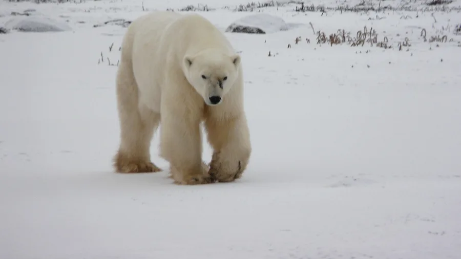
Expect luggage limits capped strictly between 40 and 50 pounds on regional turboprops, meaning heavy zoom lenses and tripod gear will force hard packing sacrifices before departure. Reaching this subarctic post on the rim of Hudson Bay requires either booking those turboprop connections into Churchill Airport or boarding a 48-hour VIA Rail sleeper from Winnipeg, creeping across hundreds of miles of fragile muskeg over tracks that buckle whenever the underlying permafrost shifts.
This trip suits older children and agile travelers who can handle enclosed vehicles for hours, but it genuinely does not work for families needing quick emergency exits or travelers with limited mobility. Armed Polar Bear Alert patrols actively guard town boundaries to keep migrating predators off the main street, while visitors view bears exclusively from custom high-clearance tundra buggies operating well above the rough coastal ground.
💡 Tip: Never walk beyond the painted street limits after dusk; polar bear patrols monitor the shoreline continuously.
10. Stehekin in the North Cascades Wilderness

The jagged summits of the North Cascades wall off one of the premier mountain towns to visit before winter, leaving you to trade asphalt for 55 miles of open water aboard the Lady of the Lake ferry, a charter floatplane, or a multi-day trek over mountain passes. Round-trip ferry fares and floatplane tickets run between $150 and $650 per passenger depending on your seasonal timing and boat hull speed.
The valley's lone gravel lane dead-ends abruptly against river timber, and every pickup truck you pass arrived on a flat-deck cargo barge. You get around on foot, on a clunky rental cruiser bike, or by flagging the red public shuttle as it rattles between the rustic cabins, trailheads, and warm morning pastry trays at the local bakery.
Choosing Your Inbound Transit Route
Bush Planes & Helicopters
- Fastest travel time over remote terrain
- Operates year-round when weather permits
- Dramatic aerial perspectives of ice and canyons
- Direct access to tiny gravel landing strips
Passenger Barges & Ferries
- Slow travel speeds spanning multiple days
- Heavily constrained by seasonal ice freeze-up
- More generous baggage allowances for gear
- Vulnerable to ocean squalls and river sandbars
11. Ittoqqortoormiit on the Eastern Greenland Coast
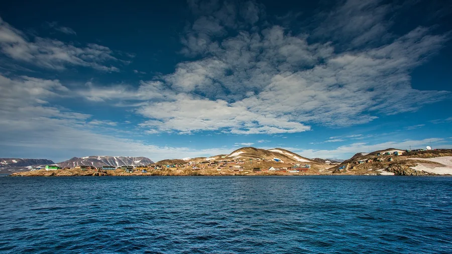
Scoresby Sound is the world's largest fjord system, and Ittoqqortoormiit sits on its frozen lip. While sheltered alpine lakes allow steady summer passenger boats, this eastern Greenland shoreline spends roughly nine months every year trapped under heavy sea ice, completely cut off from any outside road grid.
Reaching it means boarding a twin-engine plane to Nerlerit Inaat airfield followed by a mandatory fifteen-minute helicopter hop, though open-water windows in late summer briefly permit small transfer boats. You will spend quiet hours wrapped in wool on wooden benches, watching hunters maneuver dog sled teams and snowmobiles across vast sea ice routes. The lone grocery store waits on a single commercial freighter that calls only twice a year once the pack breaks.
Blizzards frequently ground the transfer aircraft and lock the water corridors for days without warning. Pack serious patience and extra provisions.
Myths About Roadless Living
12. Halibut Cove in Kachemak Bay, Alaska
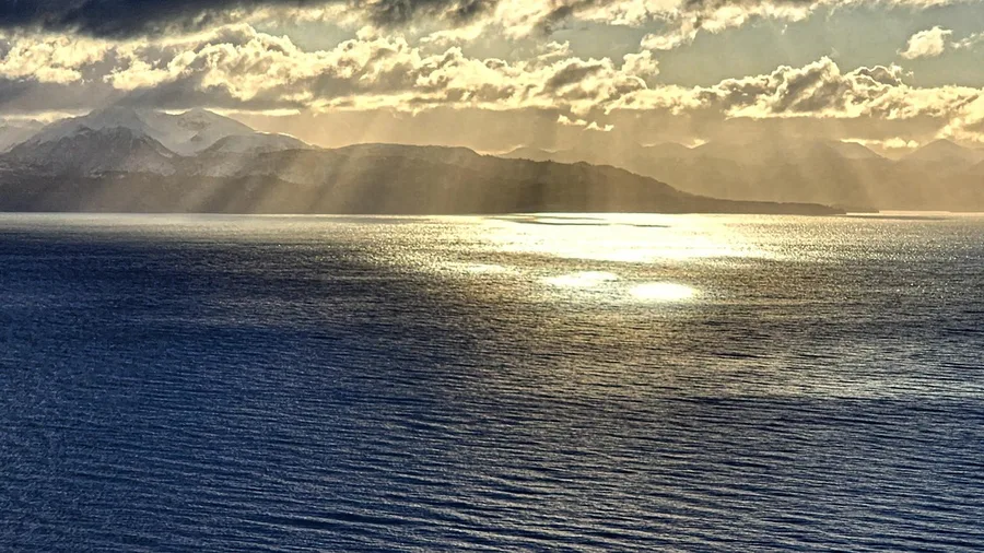
Pay the charter fare and cross Kachemak Bay by water taxi instead of turning back at the highway terminal. The Seward Highway stops cold at Homer Spit, forcing you onto a 45-minute crossing to reach this car-free island enclave across the bay, with boat taxi transfers easily costing between $150 and $200 per seat.
Rather than driving over tundra, you walk along elevated cedar boardwalks while skiffs cut through sea channels below your feet. Giant twenty-foot tides dictate every landing window, and local crews muscle incoming groceries and bags off the floating dock using hand-trucks and small utility haulers.
💡 Tip: Check Homer tide charts before booking; extreme low tides can alter passenger boat docking locations.
Frequently Asked Questions
How do residents get medical care in towns without roads?
Most roadless communities maintain small municipal clinics staffed by resident nurses or paramedics for routine care. For acute medical emergencies, regional search and rescue teams dispatch dedicated air ambulance helicopters or pressurized turboprops to evacuate patients to major regional hospitals.
Are groceries much more expensive in roadless settlements?
Yes, grocery prices routinely run 30% to 150% higher than on the road grid. Perishable goods like fresh milk, eggs, and fruit must fly in on cargo aircraft, while non-perishable goods arrive on seasonal summer freight barges.
Can you bring your own car to any of these destinations?
A few marine destinations like Juneau allow you to transport personal vehicles via scheduled roll-on/roll-off passenger ferries. However, places like Zermatt, Civita di Bagnoregio, and Supai strictly prohibit private automobiles entirely, requiring visitors to park in perimeter lots outside.
What happens if severe weather grounds your outbound transport?
Weather delays are standard in remote travel. Bush planes and ferries frequently cancel departures due to blizzards, heavy sea swells, or thick fog. Travelers should always carry two extra days of vital medication and maintain flexible onward travel connections.
Is satellite Wi-Fi available in these remote outposts?
Most roadless settlements now utilize low-Earth orbit satellite internet networks at local hotels and community buildings. However, cellular coverage remains spotty, and harsh mountain or fjord topography can block satellite line-of-sight during storms.
Choose Your Settlement by Travel Tolerance
Match your destination to your tolerance for delays before you book, because weather regularly strands inbound boats and turboprops for days. If a delayed flight will ruin your week, stick to canal hamlets like Giethoorn or train-fed alpine zones like Zermatt where schedules hold firm.
When you aim for deeper wilderness outposts like Supai, Churchill, or Ittoqqortoormiit, weigh your gear down to the mandatory 40 to 50-pound limit and purchase dedicated backcountry medical evacuation insurance before departure. These roadless towns prove modern society thrives without a highway: leave the car behind, buy your passage on the water or the gravel runway, and step onto streets where engines never dictate the pace.
Audit Your Backcountry Packing Weight
Review our logistics table above and trim your gear to meet regional bush aircraft weight limits before booking your transfer.